Aarhus (Risvangen district) represents a well-developed urban area served by a separate stormwater system designed to safely convey runoff and discharge it through defined stormwater outlets to receiving waters, including the Bay of Aarhus. The city has dedicated efforts to develop plans for mitigating climate change effects, mostly based on innovative blue green infrastructure that has been proven to be effective, economically beneficial, and adaptative to the urban landscape. Within WATERUN, four treatment systems were selected among several systems already established within the city: two surface treatments and two infiltration-based systems. The four innovative systems were designed to operate without the input of external energy; they are well integrated in the landscape and with high acceptance from the public.
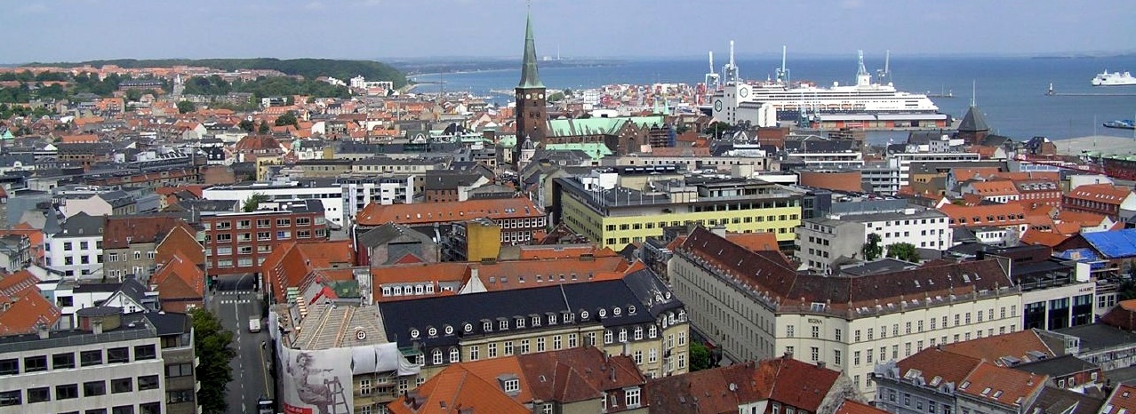
Figure 1: Aarhus from town hall. Source: BØDSKOV (2005)
Site context
Aarhus is one of three case studies (alongside Santiago de Compostela and Amman) chosen to obtain data and to elaborate, perform and validate the proposed WATERUN methodology. These case studies have been selected according to different climate conditions, land use and level of implementation of measures for diffuse pollution, in order to validate the tools in different scenarios.
Additionally, the Aarhus infrastructure was calculated and designed to meet the expected increase in precipitation from climate change. This type of infrastructure is commonly referred to as climate change mitigation systems and is designed to mitigate the increase of rain in terms of flow and intensity as well as to treat the influent waters and remove pollutants before water is discharged in natural receiving waters. To comply with the objectives of the WATERUN project, and after visiting several green infrastructures for the mitigation of climate change in the city, the Aarhus Vand (AV) and Aarhus University (AU) team selected four sites that represent some of the technologies developed in Denmark. When selecting the sites, the team aimed to research runoff waters from different types of urban agglomerations to assess waters of different quality. The four sites are located in urban areas.
WATERUN activities at this site
All four WATERUN tools were applied in Aarhus. Detailed protocols, datasets and results are described in the corresponding tool factsheets:
- Tool 1 - Portable monitoring system to identify the presence of microplastics and PAHs in-situ - PAHs and MPs sensors were validated with real water runoff samples during the summer (August 2025) and Autumn (November 2025) seasons. The influent and effluent of an infiltration system (dry pond) located at Tulip were sampled at different times during a rain event. Two other sites at Risvangen and Lystrup were also sampled and analysed for PAHs and MPs presence.
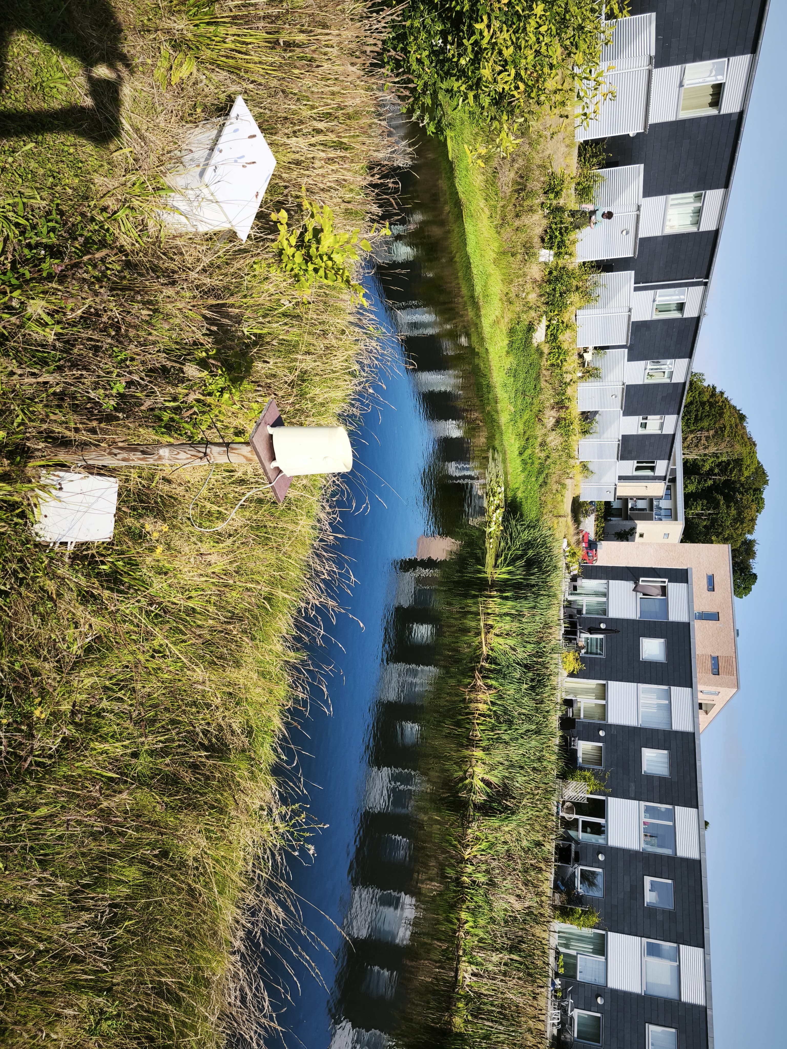
Figure 2. Tulip wet pond. Source: DCU (2025)
- Tool 2 - CleanCityCover was parameterised for four sub-areas in Aarhus: Area 1 in the heart of the city, of predominantly commercial land use, with large paved areas, a major road with heavy traffic and a substantial number of copper roofs; Area 2, a newly developed residential area away from the city with existing green infrastructure (wet pond), low-traffic roads and galvanized roof gullies; Area 3, a residential area situated along the major outer ring road; and Area 4, again a residential area, with existing green infrastructure (dry pond). The tool was validated at two study areas (Area 2 and Area 4) for runoff concentration of heavy metals copper, zinc and total nitrogen, using runoff samples collected in 2024–2025 as part of Working Package 4 of WATERUN.
- Tool 3 - MUST-B Planning Toolkit was applied to the Risvangen district, a well-developed urban area served by a separate stormwater system. The model is not intended to reproduce monitoring data or represent the detailed design of the existing system; rather, it provides a simplified, planning-scale representation of the contributing area to support early-stage scenario screening. In consultation with Aarhus Vand, infiltration-based decentralised interventions were considered unsuitable due to local soil conditions and a high groundwater table; the focus was therefore placed on retention-based measures and their ability to reduce discharge volumes at stormwater outlets.
- Tool 4 - Decision support system based on health and environmental risk was applied to evaluate chemical risks and regulatory compliance associated with urban water runoff (UWR) treated by four Sustainable Urban Drainage Systems (SUDS), focusing on the assessment of chemical risks associated with heavy metals through Quantitative Chemical Risk Assessment (QCRA) and the evaluation of compliance with the requirements of the new EU Urban Wastewater Directive (EU) 2024/3019 for selected key parameters (Total Nitrogen, Total Organic Carbon, and Total Phosphorus). The map of the city of Aarhus was dynamically updated by the EWS tool to show in real-time the current alarm conditions for each point of interest.
Blue-Green Infrastructure deployed in Aarhus
The four selected sites represent some of the technologies developed in Denmark. Aarhus City embarked in a proactive approach to cope with runoff treatment, both in terms of reducing water pulses as well as removing pollutants before discharging waters in natural recipients.
Tulip — Infiltration ditches
Type of facility: Infiltration system. Treatment target: Urban runoff. Catchment area: 5 ha. Filter media: 400 mm infiltration layer of engineered soil; native plant species, forbs and grasses.
The infiltration ditches are in the Tulip area (former industrial area) in the western part of Aarhus. The Tulip area is designated as a ground water recharging pilot area, where urban runoff from a newly developed residential area is treated before being infiltrated to recharge aquifers. The infiltration ditches are passively fed by gravity during rain events. Runoff is collected and conveyed on the surface and in internally connected basins before being infiltrated. The infiltration media consists of 400 mm engineered soil (mulch and sand) on top of a sand foundation. The ditches are planted with native vegetation.
- Advantages: Passive system with low maintenance; retains runoff and mitigates flooding; recharge of aquifers; enhances biodiversity in urban settings.
- Disadvantages: Potential risk of contaminants reaching the aquifers; high area demand.
Tulip — Wet detention pond
Type of facility: Wet detention pond. Treated medium: Urban runoff. Location: Tulip-grunden (east), Western Aarhus. Catchment type: Traditional, urban development. Catchment area: 2.2 ha. Sewer system: Separated. Retention volume: 643 m³. Total volume: 1,206 m³.
The wet detention pond collects stormwater from a new established urban development. Stormwater is collected from surface waters, draining from roofs, roads and green areas, then transported by gravitation in pipes and discharged in the wet pond, where sedimentation and biological processes remove pollutants from the collected waters. Among the expected pollutants are suspended solids, dissolved solids, PAHs, heavy metals, nutrients, microplastics, and organic matter. The outlet flow is regulated by a water break. To evaluate the performance of the system, samples are taken when rain events occur, and an automatic sampling device triggers once the rain event is sufficient to produce runoff. Water samples from the influent and effluent are collected by an automatic sampler and evaluated for the different parameters at the AU lab. Stormwater flow, both inlet and outlet, is obtained through modelling, by use of water level measurer and rainfall data.
Risvangen — Infiltration bed (dry pond)
Location: Risvangen (Gustav Holms Vej), Northern Aarhus. SUDS-Type: Infiltration bed (dry pond). Catchment type: Residential area (connected/town houses). Catchment area: 0.5 ha. Sewer system: Separated (stormwater on terrain). Retention volume: 3.5 m³.
The infiltration bed collects stormwater runoff (roofs, gardens and road) from an upstream housing road, Polarvej, along with runoff partly from Gustav Holms Vej. Stormwater is transported on the surface and is directed to the treatment system. Once it enters, water is infiltrated in the planted bed. The bed was designed to guarantee rapid infiltration and is constructed with a top layer of 70 mm gravel, a mid-layer of 300 mm filter soil, and a bottom layer of 300 mm gravel to ensure successful treatment and retention of pollutants. Once the water trickles through the media it is drained at the bottom of the bed to a pipe that conducts the water downstream to nature. Samples of stormwater runoff are collected at both influent and effluent of infiltration system. Flow at inlet and outlet is monitored as well.
The Risvangen site is part of a large-scale innovative climate-adaption project and was selected to evaluate the performance of the large Risvangen system, which covers a total area of approximately 40 ha. Stormwater is primarily transported on terrain in ditches, beds, drains and retention 'terraces'. The entire system has been established to treat runoff waters as well as to provide additional environmental services and leisure and recreational activities, as well as reducing vehicle speeds to increase road safety.
Lystrup — Wet detention pond
Location: Lystrup. SUDS-Type: Wet detention pond. Catchment type: Mixed urban areas / light industry. Catchment area: 17 ha (direct), 93 ha (retained). Sewer system: Separate sewer system.
The wet detention pond B928 collects stormwater runoff from a large catchment area. However, through the upstream catchment area, several detention ponds connected through the system retain the stormwater through the catchment area. Stormwater is released internally to the system in a controlled amount; 93 ha is internally retained in these stormwater ponds. The wet detention pond is the most downstream. The basin directly collects stormwater from 17 ha, while also collecting the retained stormwater from the upstream catchment areas. Stormwater samples are collected by use of automatic sampler (ISCO). Stormwater flow, both inlet and outlet, is obtained through modelling, by use of water level measurer and rainfall-data.
Stitched panorama foto from top of the Århus rådhus over bugten and harbor (Denmark)
Deliverable D3.4. Manual of the planning tool to model the reduction of pollution runoff, CSO and pollution discharge to water bodies
Manual of the MUST-B block-based planning toolkit, applied in the Cancelón catchment of Santiago to assess the potential of decentralised low-impact development measures to reduce combined sewer overflow volumes.
WATERUN CONSORTIUM (2026): Deliverable D3.4. Manual of the planning tool to model the reduction of pollution runoff, CSO and pollution discharge to water bodies. In: WATERUN Project, EU Horizon Europe Grant Agreement No. 101060922. Lead Beneficiary: UFZ. Document not yet publicly available:Deliverable D5.3. Decision-support framework and mapping tool for water quality and risk analysis provision
Report with the description of the final implementation of the risk-based DSS in the CS of Santiago and Aarhus, including the algorithms for QMRA and QCRA analysis and the display of results in the GIS-based mapping tool for different reuse scenarios.
WATERUN CONSORTIUM (2026): Deliverable D5.3. Decision-support framework and mapping tool for water quality and risk analysis provision. WATERUN Project, EU Horizon Europe Grant Agreement No. 101060922. Document not yet publicly available.Deliverable D5.4: Implementation of EWS for a safe UWR reuse and management
Report describing the development, configuration and complete structure of the Early Warning System, including outcomes of the performed simulations in the case studies of Santiago and Aarhus.
THE WATERUN CONSORTIUM (2022): Deliverable D5.4: Implementation of EWS for a safe UWR reuse and management. In: WATERUN Project, EU Horizon Europe Grant Agreement No. 101060922. Document not yet publicly available :Deliverable D5.6. Guidance Document on WATERUN Tools for IUWMP Support
This document consolidates the working procedures and implementation protocols of the four WATERUN tools (PRODUCT1–PRODUCT4) and presents their application to the Santiago de Compostela, Aarhus and Amman case studies, including the Blue-Green Infrastructure deployed in the Tambre and Sionlla industrial areas of Santiago.
WATERUN CONSORTIUM (2025): Deliverable D5.6. Guidance Document on WATERUN Tools for IUWMP Support. WATERUN Project, EU Horizon Europe Grant Agreement No. 101060922. Lead Beneficiary: UFZ. Document not yet publicly available.WATERUN Project
This is the official webpage of WATERUN, an EU-funded Horizon Europe research project focused on sustainable urban water runoff management. It develops innovative methodologies based on Water-Sensitive Urban Design (WSUD), offering cities both preventive and mitigation solutions for urban water challenges.
WATERUN.EU (2022): https://www.waterun.eu/ [Accessed: 15.04.2026]CleanCityCover tool (parameterised for Aarhus)
Shiny web application of the CleanCityCover tool parameterised for four sub-areas in Aarhus.
Technical University Berlin (n.d.): https://boneyj.shinyapps.io/app2/ [Accessed: 15.04.2026]