Executive Summary
Principally, locality mapping serves as a tool to provide a visual representation of information in a particular geographical context. It is based on a stakeholder’s perception with the focus on a certain issue of interest. The regarded topics can vary: geographical and physical conditions, such as available resources and their use can be analysed with locality mapping as well as the differentiated use of natural resources by land users and the potential dangers and threads concerning the use (IFAD 2009). For the purpose of assessing the current status, locality mapping can be used as a tool to analyse and present the identified situation of the water and sanitation system in a given local context.
Purpose of Locality Mapping
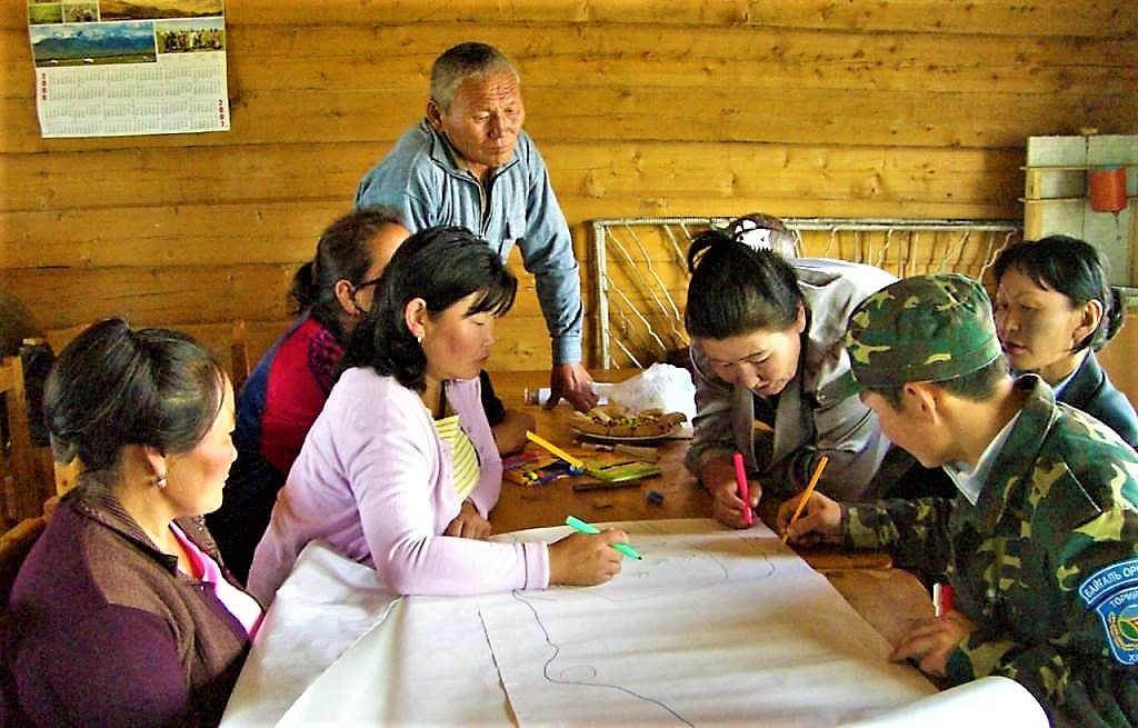
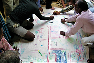
Locality mapping is designed to be a participative process. However, at the beginning of a planning process, locality mapping can be a helpful tool to get an initial overview with the help of only a limited number of selected locals or experts who are familiar with the area and the concerned issue (see also stakeholder analysis starting by stakeholder identification factsheet).
Locality mapping is strongly related to participatory mapping and focuses on the identification and presentation of water and sanitation related issues, whereas participatory mapping in general provides a greater function of influencing the internal dynamics of a community and a local setting in the decision making (see PPT) process.
If you need more information about participatory mapping, click here.
Maps allow to collect and position information and to recognise spatial relationships. The best sources of information for drawing a map are the people living in the area (WORLDBANK 1996). The collectively gained information should create a consensus under the involved stakeholders. Besides, many people can provide more information than a single person can. At the same time, participatory mapping helps to gain an insight how the involved people think and how they set their priorities.
Participatory mapping is, as the name indicates, a participative process. The more people participate in a mapping process, the more insights on the issue can be collected. However, to start a SSWM process, a locality mapping exercise with just a few locals or experts who are familiar with the area and the concerned issue can gain valuable first insights. Later, to get the full picture, the mapping should be repeated in a full participatory mapping process with the community.
Subscribe here to the new Sanitation and Water Entrepreneurship Pact (SWEP) newsletter. SWEP is a network of organizations joining hands to help entrepreneurs design and develop lasting water and sanitation businesses.
Steps for Locality Mapping
The following instruction is intended for a participatory use. However, it can be managed also as an individual on the desk or with a small group as a part of preparation.
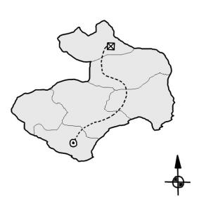
1. Ask the individual or the group to draw the boundaries of the geographic unit being discussed. Participants or the planner can decide how they want to represent this – on paper with writing or using local materials such as wet sand and earth with sticks, stones or seeds. Remember that whatever material is chosen, you will always need a paper-based copy to enable comparative analysis. If it adds to the discussion, three-dimensional elements can be added, transforming the map into a model that emphasises landscape-level aspects of issues. This base map can be multiplied and used for different contexts.
2. On whatever medium is chosen, ask the participants to draw the basic outline of the local area, for example, roads, towns or rivers to get an accurate map, One way to do this, if you have the proper resources, is to project an overhead map onto a large sheet of paper and then to trace the required information.
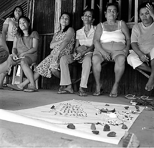
3. Having prepared the map, which could be as large as a wall, people can then add their information either directly or by using sticky notes, or also by using all kinds of different material (e.g. rocks for mountains, rice grains for fields, etc.) Be creative! Using other material than just pens is also more inclusive towards those who are illiterate. Let them record what is most significant to them, and then ask for more detail if something you are interested in is missing.
To collect the most important information about the SSWM system of interest, use the following guiding questions to add the missing information:
- Which are the problems a community is confronted with (related to water or sanitation)?
- Where are these problems located?
- Where are the hotspots of these problems? Which are the worst?
- Potentially: Who is responsible for these problems?
- Are problems connected to each other? How do the problems influence each other?
- Are there good examples?
You can also orient yourself to the understand your system chapter. This chapter explains which information should be included in the map and also questions how to ask for this information.
4. Several modifications to the map may be needed before those involved are happy with the final result. Include additional written comments such as quantities of interest, if necessary.
5. Once a "base" map has been made, subsequent meetings can use it to make comparisons and additions.
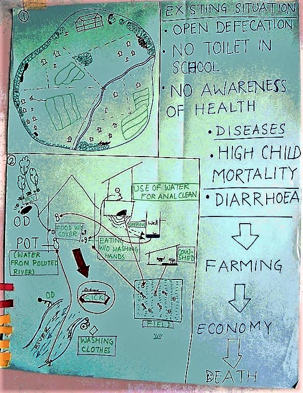
If one has completed the mapping process, the “base” map can be used to present the current status. As stated above, the map is very valuable as an illustration of the starting condition, to make comparisons during the ongoing process.
- Only those issues that have a geographic distribution are useful to analyse with maps.
- Maps are useful for obtaining a better understanding of an area being studied, and for providing information and ideas on local perspectives of, for example, resources or access to services/facilities.
- Maps are useful for presenting the gathered information in a nice and understandable way and to make comparisons of the starting conditions and the ongoing process.
- It is very reasonable to combine this assessment tool with others (water resource assessment, integral description of the settlement conditions, transect walk etc.) and to connect and complete the gathered information relevant for the assessment process.
Good Practices in Participatory Mapping
This report explores the power of participatory mapping. Covering a range of techniques, intermediaries, tools and impacts, it is shown how a systematic approach could contribute to addressing conflict-related issues and improving community ownership in sustainable environmental and natural resource management.
IFAD (2009): Good Practices in Participatory Mapping. Rome: International Fund for Agricultural Development (IFAD) URL [Accessed: 04.05.2010]Multi-Stakeholder Processes: Locality Mapping
This document by the MSP Resources Portal of the University of Wageningen, Centre for Development Innovation, gives a short but concise overview of locality mapping. The link http://portals.wi.wur.nl/msp/?page=1230 also describes other tools for multi-stakeholder processes.
MSP RESOURCE PORTAL (2009): Multi-Stakeholder Processes: Locality Mapping. Wageningen: Wageningen UR Centre for Development Innovation. [Accessed: 04.05.2010] PDFThe World Bank Participation Source Book
The World Bank understands participation as a process through which stakeholders influence and share control over development initiatives. The sourcebook shall help the reader to discover how this can be provided. Note that due to the large file size of this document, some pages were cropped.
WORLD BANK (1996): The World Bank Participation Source Book. (= Environmental Management Series ). Washington: World Bank URL [Accessed: 04.05.2010]Good Practices in Participatory Mapping
This report explores the power of participatory mapping. Covering a range of techniques, intermediaries, tools and impacts, it is shown how a systematic approach could contribute to addressing conflict-related issues and improving community ownership in sustainable environmental and natural resource management.
IFAD (2009): Good Practices in Participatory Mapping. Rome: International Fund for Agricultural Development (IFAD) URL [Accessed: 04.05.2010]Stakeholder Engagement Strategies for Participatory Mapping
This publication provides some simple strategies for facilitators leading a participatory mapping process. While there are many aspects of participatory mapping, the document focuses primarily on stakeholder involvement.
NOOA (2009): Stakeholder Engagement Strategies for Participatory Mapping. Charlston: National Oceanic and Atmospheric Administration (NOAA) URL [Accessed: 29.06.2019]Multi-Stakeholder Processes: Locality Mapping
This document by the MSP Resources Portal of the University of Wageningen, Centre for Development Innovation, gives a short but concise overview of locality mapping. The link http://portals.wi.wur.nl/msp/?page=1230 also describes other tools for multi-stakeholder processes.
MSP RESOURCE PORTAL (2009): Multi-Stakeholder Processes: Locality Mapping. Wageningen: Wageningen UR Centre for Development Innovation. [Accessed: 04.05.2010] PDFParticipation and Social Assessment: Tools and Techniques
This resource kit aims to share information and experiences on participatory methods in the context of development cooperation. The primary focus concentrates on providing practical guidance and case examples.
RIETBERGEN-McCRACKEN, J. NARAYAN, D. WORLD BANK (1998): Participation and Social Assessment: Tools and Techniques. Washington: World Bank URL [Accessed: 10.05.2010]The World Bank Participation Source Book
The World Bank understands participation as a process through which stakeholders influence and share control over development initiatives. The sourcebook shall help the reader to discover how this can be provided. Note that due to the large file size of this document, some pages were cropped.
WORLD BANK (1996): The World Bank Participation Source Book. (= Environmental Management Series ). Washington: World Bank URL [Accessed: 04.05.2010]Participatory Rural Appraisal in the Southern Gobi
The paper documents the research on implementing Participatory Rural Appraisals (PRAs) to investigate water related concerns and vegetation dynamics of herder and vegetable farmer communities in the southern Omnogovi aimag (‘province’) of Mongolia.
HAWKINS (2006): Participatory Rural Appraisal in the Southern Gobi. Not published